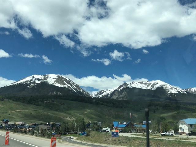
Today we make our drive from Rocky Mountain National Park to the Black Canyon of the Gunnison National Park in Montrose, CO. We ended up taking the scenic route next to the mountains to get to I-70. We went through quite a few really cool mountain towns, including on that popped up out of nowhere! Black Hawk, CO is a huge casino town built in the mountains. When I say huge, I mean HUGE. I counted as least 8 casinos just that we could see along the road, and they towered above us! Obviously, with the COVID-19 crisis, all the casinos were closed. This was probably beneficial to us getting through the town in a timely manner. I looked it up later, and the entire town is only 2 square miles and has a population of just 118 people! They also have a long standing war with Central City on who can get the most gamblers from Denver. Central City even built their own parkway that leads right to their casinos from I-70! According to the internet, Black Hawk is still winning.
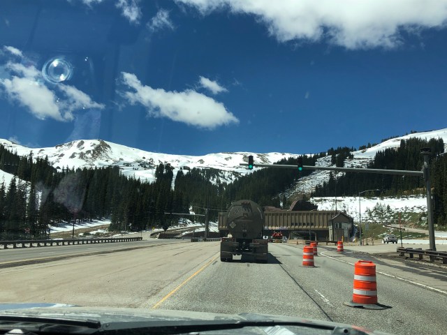
We made our way around, and through, the mountains. There was a lot of construction and one lane highway through this area. We went through the Eisenhower tunnel, which was rather neat!
After MANY ore hours than originally anticipated (our original route of going through the Independence Pass had restrictions associated with vehicles over a certain length and had a hefty fine of over $1,000 for breaking it!), we finally arrived at the Black Canyon of the Gunnison National Park!
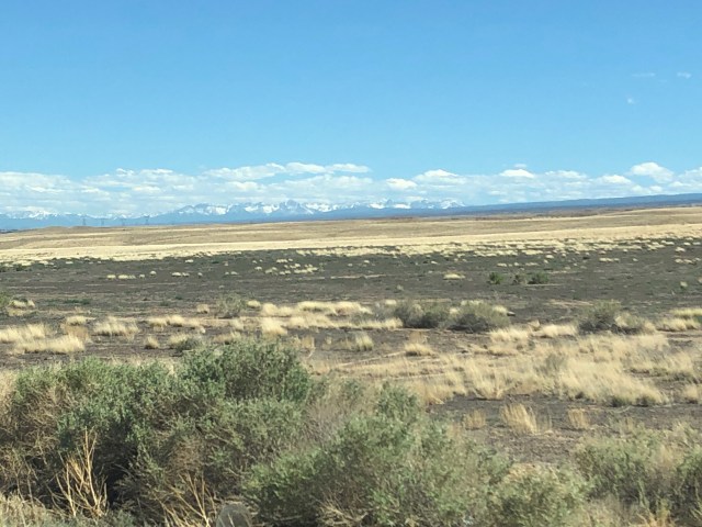
When driving to the park, you are surrounded by just absolute nothingness and desert. Then, when you finally turn on the road that leads to the park, you are surrounded by ranches and cows and green fields. Much of this road is used for private land and homeowners as well. Going from the city of Montrose that is right outside the park, we climbed almost 2,000 feet in elevation!
Currently, there is no fee to enter the park. We think that with all the problems they have with staffing the National Parks right now and trying to follow COVID-19 procedures, they just don’t have the ability to staff everything. If you are in the area, make a trip up and get in for free! The Black Canyon of the Gunnison National Park was established in 1999. There is both a North and South Rim to the park. Most people just visit the South Rim. There is not an easy way to get to the North Rim from the south side, and in order to get there you have to drive about 3 hours out of the way, then down an 11 mile gravel road. The North Rim is not as developed, and most of the park activities and areas are on the South Rim.
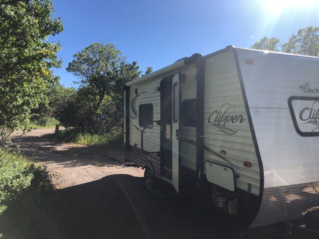
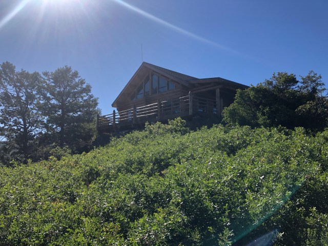
We found our campsite on the South Rim rather easily, and were glad to see that it reminded us of our campsite in Glacier NP last summer. We were surrounded by trees and greenery. We could see our neighbors, but still had a lot of privacy.
After setting up camp, we ran back into town to the local Walmart for some much needed supplies (tiny fridge in the camper is not conducive to eating every meal “at home”). Once we got all our supplies, we went back to the camper, cooked a good meal, and enjoyed some star gazing.
The next morning in BCGNP brought us an early wake up call. Our campground had hiking trails right off it, just like in the Rockies! We took the Rim Rock Trail to the visitor center (about 1 mile). What we didn’t realize until we entered the trail were three things:
- Dogs were not allowed on trails in the park currently because of the deer. Apparently, deer often give birth near the campground and will fight/kill anything they deem a threat. A woman several year ago almost died after being attacked by a deer while walking her dog!
- We were in an active bear area. While this is certainly not new to us (if you have heard our bear story from the Adirondacks when we got engaged), we were surprised that bears would be in the area.
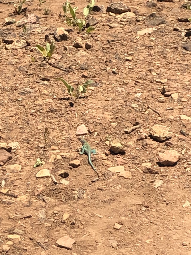
- WE WERE IN AN ACTIVE MOUNTAIN LION AREA. Now, both of us agree that we enjoy seeing wildlife, from a distance. Last summer, we had a ranger in Glacier talk with us on a hike about seeing mountain lions and how terrifying it really is. The sign we saw told us if a mountain lion attacked us, we should fight back. Ranger Julia last summer even told us that mountain lions aren’t very affected by bear spray. So instead of doing my normal “HERE BEAR-clap-clap-clap” when going around corners, I changed my call to “HERE MOUNTAIN LION” followed by karate sounds to it would know we were too dangerous to mess with!
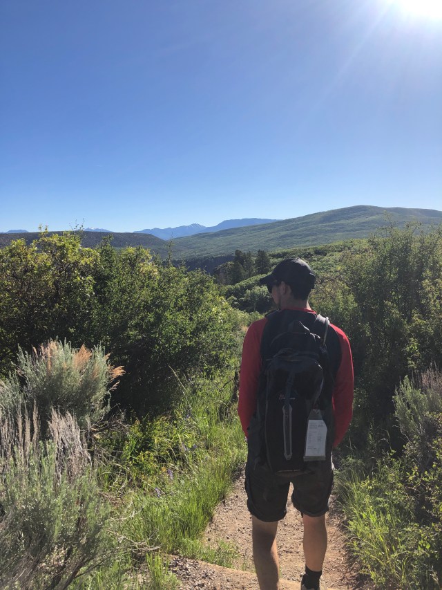
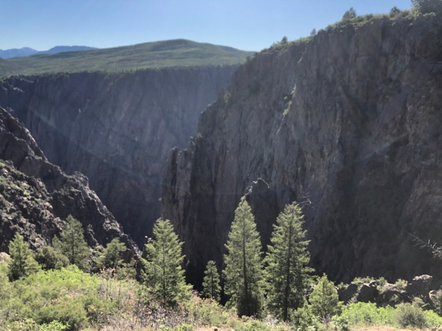
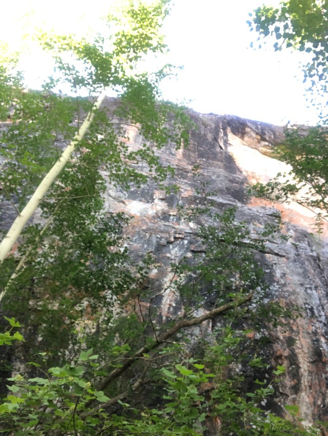
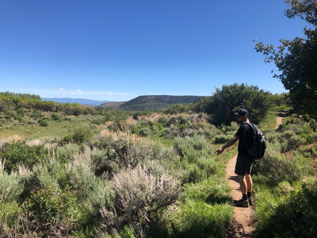
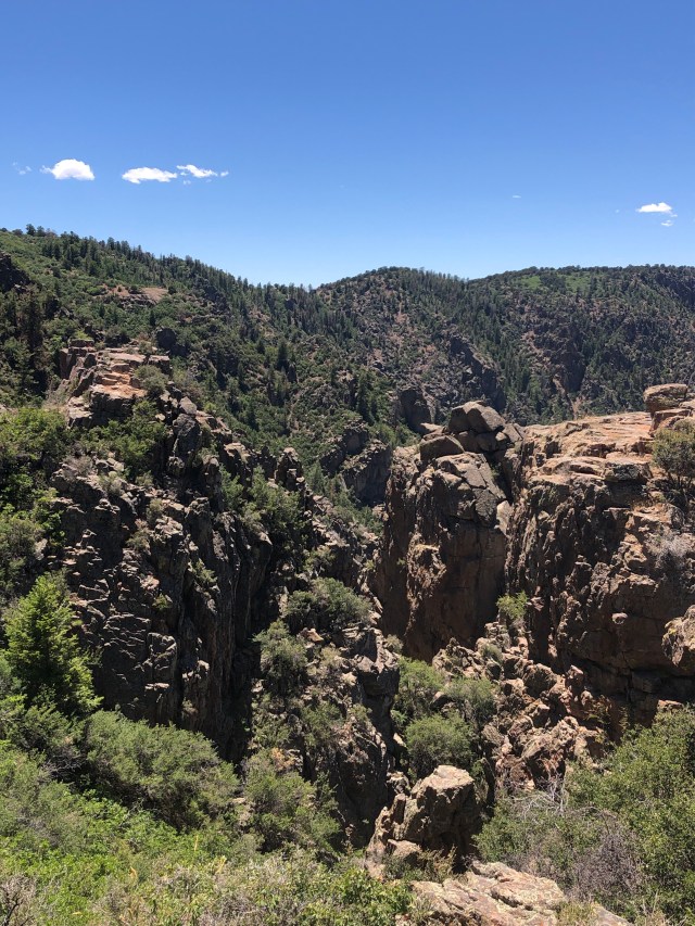
Once we arrived at the visitor center, we were able to get a park map. The visitor centers at nationals parks are still closed, so we just walked around the outside of it. It was a really nice visitor center tucked into the vegetation! There was a little outlook at the visitor center that we walked out to, then headed out on the Oak Flat Loop trail. This trail has a deceiving name, as it is not a flat trail! It wasn’t too hard, just some steep areas. This loop was around 2 miles long, and we got off of it right before arriving back at the visitor center. This trail was so cool because you were tucked in the sides of the canyon in all the vegetation and we were able to see the canyon in a very unique and different way!
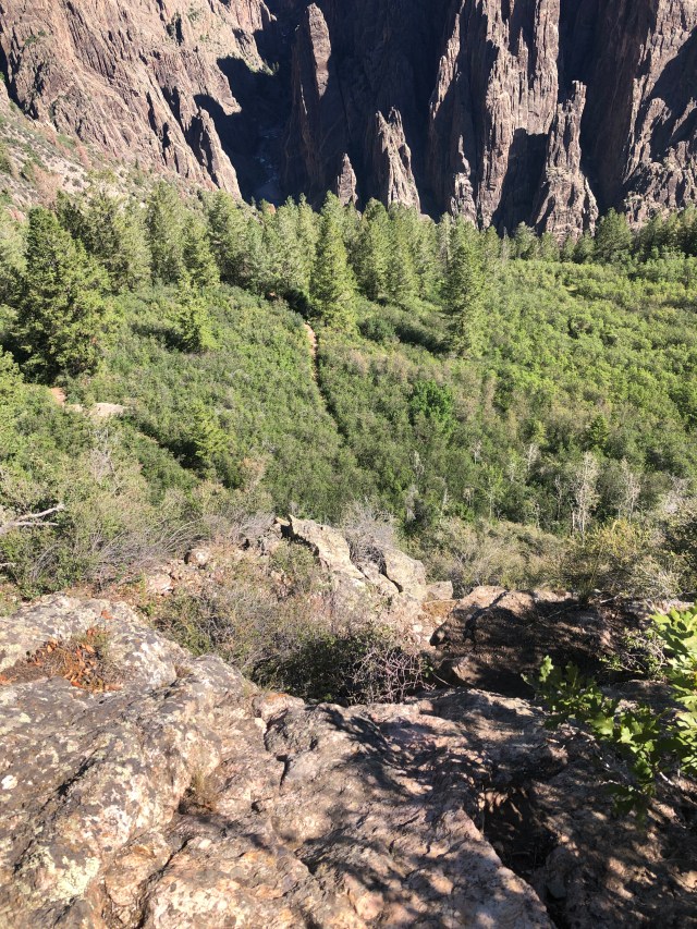
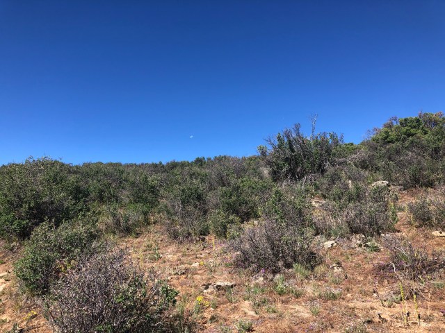
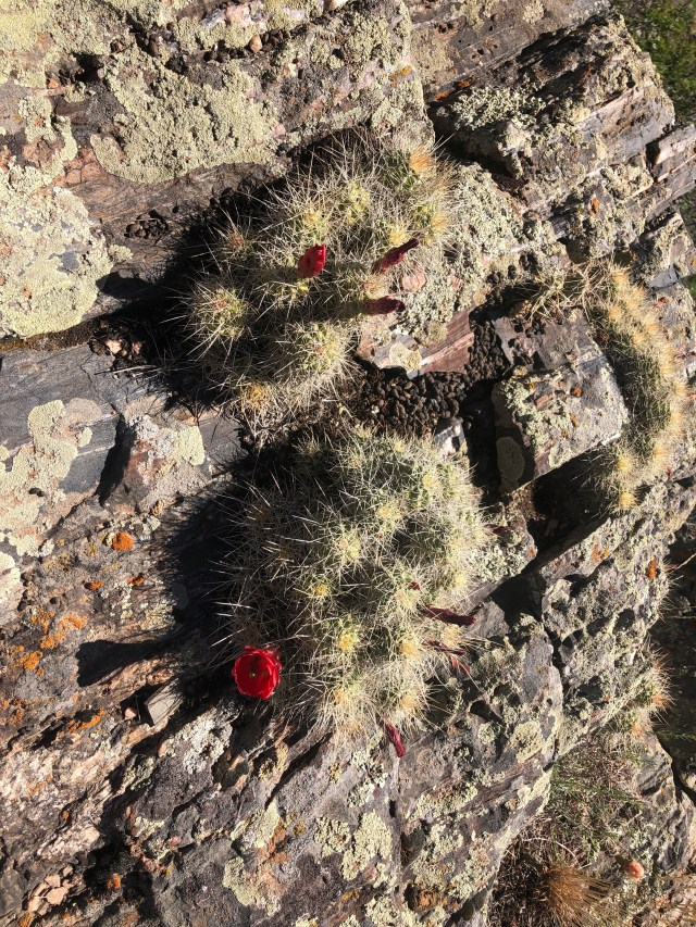
From the Oak Flat Loop trail, we go on the Uplands Trail. Aptly named, as we were now at a higher and rockier elevation. With this increased elevation, we had a lot less tree coverage. This was a huge contrast to the trail we had just walked. We even saw some cacti!
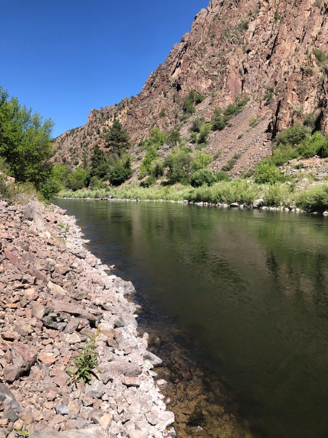
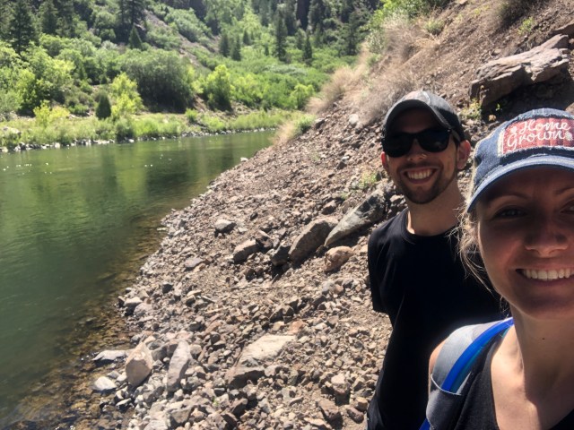
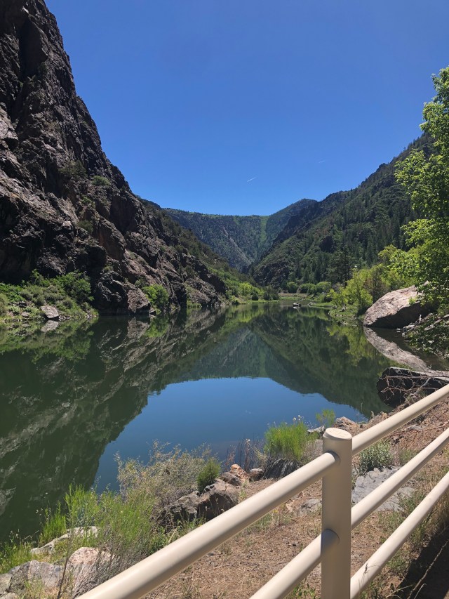
The Uplands Trail brought us back to the Rim Rock Trail, which led us back to the campground. We were both a little (or a lot) sweaty and tired. We rested for a little while, but then got into the truck and headed to East Portal Road. This is a 6ish mile road with a 16% grade that takes you all the way down into the canyon and by the Gunnison River. At the end of the road, there is a dam and the Gunnison Tunnel (under water). There were a lot of signs that talked about when the tunnel was built, and how. The signs really never explained the purpose of the tunnel, however. We climbed down the side of the hill and sat next to the river for a little while, enjoying the sun and the water and watching the fishermen.
We drove back up out of the canyon and back to the camper for lunch. The nice thing about this park being so small is that we never really had to drive far away or worry about how long we spent at places.
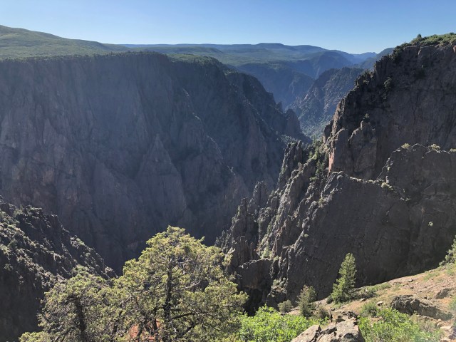
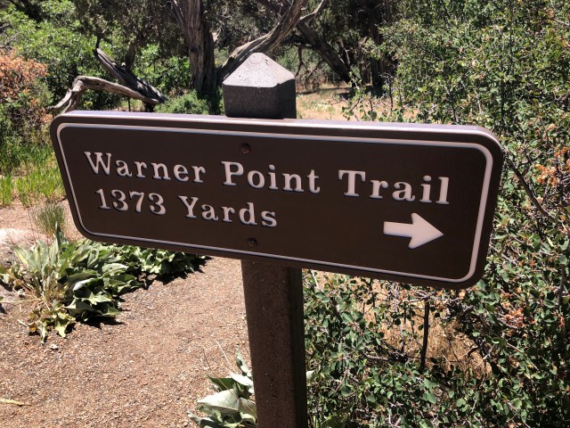
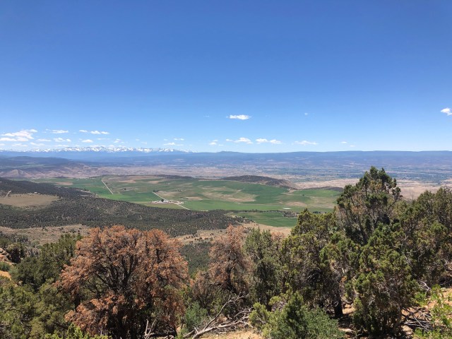
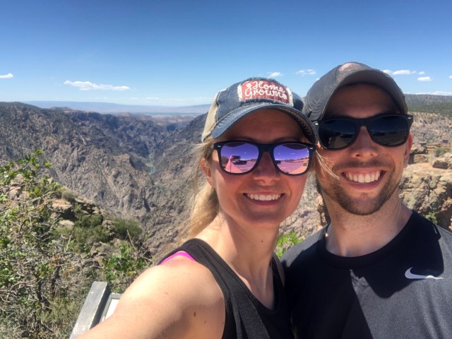
After lunch, we took the S. Rim Road drive. This is a 7 mile long road along the South Rim. There are tons of pull offs with short enough walks to some outstanding views. We passed all of these on the way up the road, as we were planning to stop on the way back down.At the end of the road, there is the High Point. At this point, we parked the truck and took the Warner Point Trail. This is a 1.5 mile roundtrip hike that has a nature/history trail guide to see you about the Black Canyon. This trail was named after Mark Warner. An Ohio native, he came to Colorado in 1917 to become a pastor. He had dreams that others would see the Black Canyon the way he did, and played a major part in the preservation of the park.
This hike didn’t disappoint. It was more strenuous than we had anticipated but the views at the end were incredible! We also met a couple that we chatted with for a while. They were Massachusetts natives, who now live in Arizona. Each year, they escape the hot summers in Arizona and travel for 3 months! They had a lot of stories to tell us and tips for our future travels.
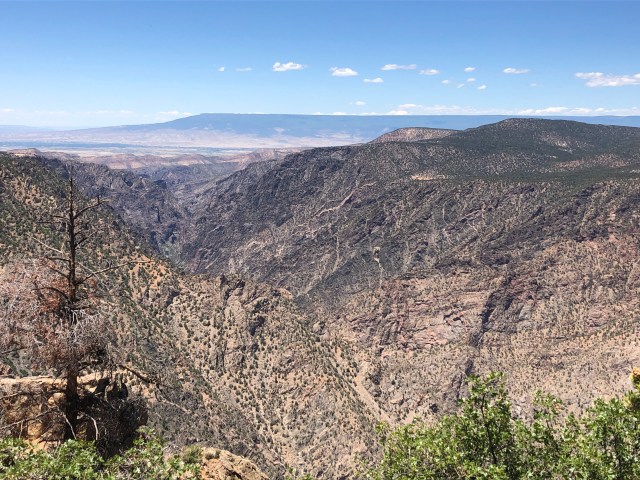
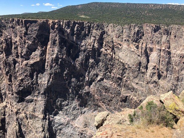
We arrived back to the car and took the drive down S. Rim Road. We stopped for a few viewpoints- Sunset View, Dragon’s Point, Chasm View, and the Painted Wall. These were all equally stunning views of the Black Canyon.
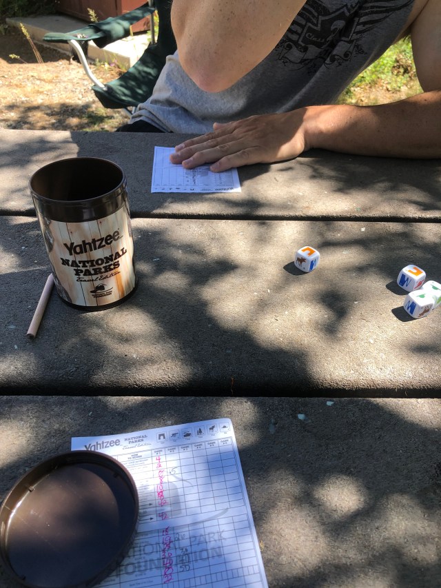
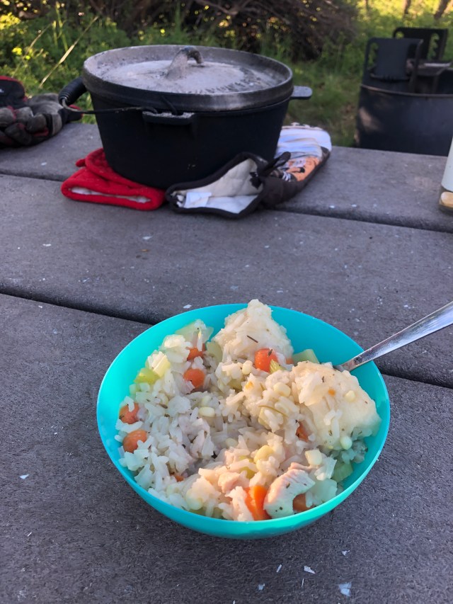
We went back to the camper, having successfully hiked almost every trail we could on the South Rim. We relaxed a little, took cold showers to get the dust and heat off our sunburnt bodies, and enjoyed some down time. We also played some National Parks Yahtzee! We busted out our new cast iron pot that has an inverted lid to hold coals. I made some really good chicken and rice soup with biscuit dumplings, and we learned a little about how to use the inverted lid (it totally worked and browned the tops of the dumplings- it was amazing!).
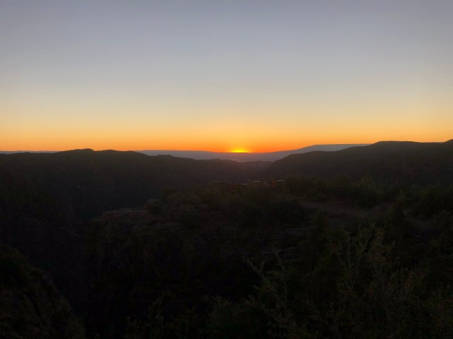
After dinner, we took the truck back up to Sunset View and watched the sun set on the Black Canyon. Perfect day 🙂
Tomorrow, we leave the Black Canyon to go to Arches and Canyonlands National Parks in Utah!

Outstanding photos of outstanding areas!
LikeLike