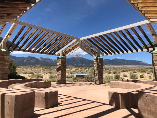
Today we leave Capitol Reef National Park to head to Nevada for Great Basin National Park. This is another small park that we didn’t really know much about before visiting! The drive was surprisingly easy and didn’t take as long as we had anticipated. Our original camping site was going to be another hour west of the park (I believe when we booked all the sites were either already reserved, or only first come first serve sites which always make me nervous). So instead of wasting time taking the camper and dropping it off to come back to the park, we left it at the visitor center in Baker so we could go ahead and enjoy the park.

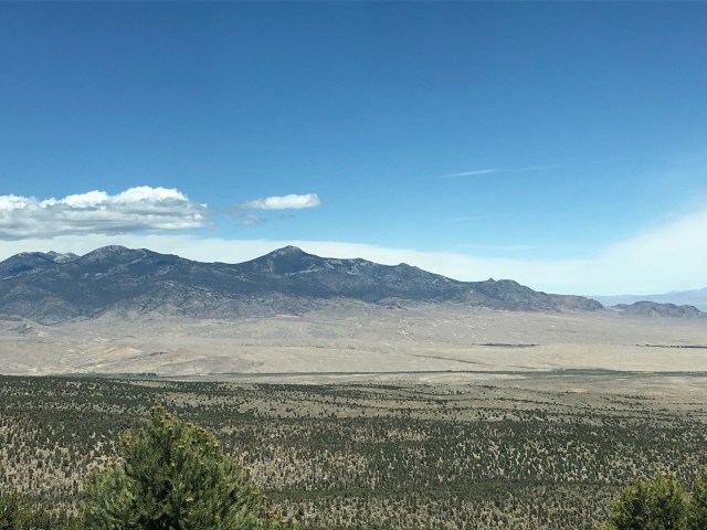
The crazy thing about this National Park is the fact that everything around it is a desert, yet the park is a mountain with snow and Nevada’s only glacier! The contrast was so odd!


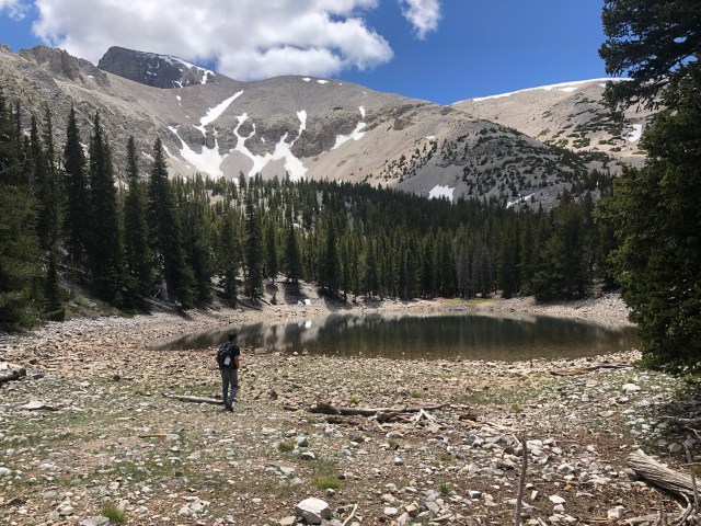
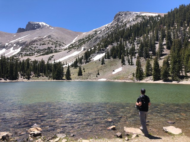
We drove up to the end of the road that leads to Wheeler Peak. We parked at Wheeler Peak and made the choice to hike the Bristlecone Pine Trail, and then the Rock Glacier trail. Hiking up the Bristlecone trail, there is a spur trail that leads to Teresa Lake. One of two alpine lakes going up Wheeler Peak, we made the short hike to the lake. It was beautiful! The lake is crystal clear, and the water was so cold! Scott left his LifeStraw in the truck, or I would have taken a drink from the lake!
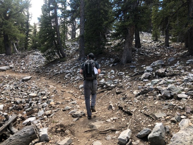
Back on the main trail, we continued up a rather steep hike to the Bristlecone Pine area. The Bristlecone pines in Great Basin include some of the oldest known trees. Years ago, a young scientist asked to cut down a tree to count the rings inside to confirm it was the oldest living tree (seems counterproductive to me). After counting the rings, he confirmed that the tree was over 4,000 years old! At that point, if I were him, I would feel like a real jerk! Luckily, he did have some feelings about the age of the tree he just killed, and he was instrumental in creating a national park at Great Basin to help preserve these ancient trees.
At the Bristlecone Pine area, there is a short interpretive trail that has signs talking about the history of Bristlecone Pines and how old some of the trees were estimated to be. We read a sign saying that it is estimated that a 4 foot tall Bristlecone is at least 300 years old! This short trail was pretty cool and we love learning more information about the parks we visit!


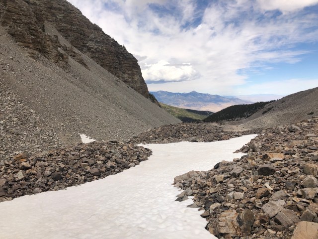
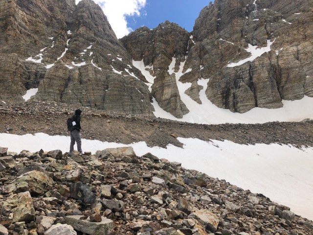
Past the Bristlecone Pine trail is the trail that leads to Rock Glacier. Scott has hiked up to a glacier before, but I have never done it so we decided to hike there! Most people who “hiked to the glacier” stopped at the informational sign that shows you where the glacier is and where the rock glacier is (it was kind of weird because we didn’t understand what a rock glacier was, and the name of the actual glacier was Rock Glacier). We, however, continued on the trail and walked through rocks and boulders and across snow. We ended up walking past the “end trail” sign and up onto the rock glacier. We probably could have made it all the way and touched the glacier, however the rocks made Scott a little nervous, and the temperature was quickly dropping as the sun had disappeared behind the mountain. This was such a cool adventure though and something we will never forget!


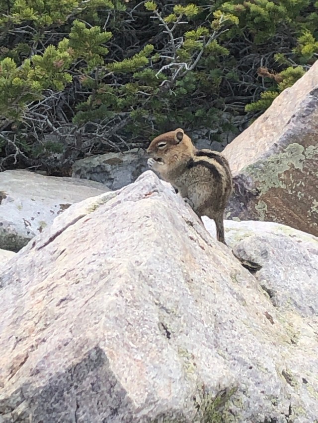
We hiked back down to where the informational sign was, sat on the bench, and had a snack. There was the cutest little chipmunk that clearly knows humans have food. He was so adorable!
We hiked back down the trail, leaving the glacier behind us. A small storm was above us and dropped some snow while we were hiking! It was so cool! A little ways down the trail, Scott realized he had dropped his shirt that was on the back of his backpack, so I hiked back up to see if I could find it (I hated the idea of leaving anything behind in the park). I came across a couple that we had talked to several times during our day’s hike, and asked if they had seen a black shirt. Luckily, the man had picked it up and placed it on a tree just past the lake spur trail. I was so happy that I didn’t have to hike back up the steep trail! I’m sure it was dropped when Scott got his phone to record the snow fall.
After retrieving Scott’s shirt, we finished our hike and headed back to the visitor’s center to get the camper. Scott had done some research, and found several BLM (Bureau of Land Management) sites nearby. We have never stayed at a BLM site before, and really had been wanting to try it out. For those of you who aren’t familiar with camping and BLM, essentially BLM sites are public land owned by the government. They have designated camping spots that people can camp at for free! There is no hookups or water or anything, but with Scott adding solar panels to our camper this year we had no issues with not having connections.
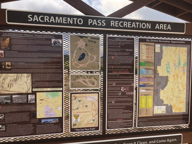
We ended up finding a spot right off the highway at the Sacramento BLM area. This was such a cool BLM. Each site had it’s own picnic area and shelter, including a fire pit and a bbq area! It was very nice!


We made some dinner and went to sleep- definitely enjoying the cool desert nights! We don’t get many cool nights in Ohio with the humidity.
The next morning, we headed back into the park. We stopped at the Lehman Caves visitor center just to see if the caves were open (they were not). This is another part of the park where you can go on guided tours of the caves in the mountains! A bummer we couldn’t go, but with COVID-19 a lot of things have been postponed/suspended.
We drove back up to the Wheeler Peak parking area, and started our hiking with the Interpretive Forest Trail. This trail led through the forest and had signs to tell you about the flora and fauna in the park. We then hiked the Alpine Lakes trail, taking us to Stella Lake and Teresa Lake (the other side of it!). These lakes were just so incredible. It was so calm and peaceful and quiet. At each lake, we took some time to sit and listen. When we got to Teresa Lake, there were several over people there.


At one point, Scott spotted something shiny in the water. He “dared” me to go retrieve whatever it was, so naturally I tried. I had to take off my shoes and socks and roll up my leggings. However, my attempt was in vain. With the water being so clear, it is deceiving how deep it is! My leggings couldn’t roll up further than above my knees, and they had just started to go into the water when I decided to bail on my attempt. From what I could tell, the shiny thing in the water looked like someone’s necklace with a pendant on it. Hopefully someday someone can return it to it’s owner!

We hiked back to the truck and headed back to the camper for lunch. We had decided after driving through the town of Baker that is right outside the park that we would go to dinner at a place called Kerouac’s, so we bummed around a little until that time. We were not disappointed by our meal at Kerouac’s. They had a very small menu consisting of sandwiches and some other items, and also had a full bar! We both got the 16 spice chicken sandwich. I have to say, I’m not usually a chicken sandwich kind of girl but this sandwich was AMAZING. I have never tasted anything so good! I also got a cucumber gin drink, which was equally delicious! If you are ever in this area, you will definitely want tot make a stop here!

After dinner, we headed back to the camper to enjoy the evening and made our plans for the drive back into Utah the next day! Tomorrow, we will be heading to Bryce Canyon and Zion National Parks!

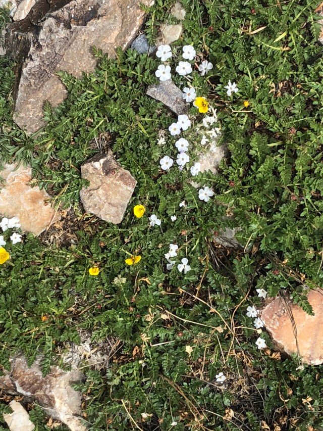
Love the photos of the little alpine wildflowers.
LikeLike
Me too! We love seeing all the different flowers that grow out west!
LikeLike